- Thursday, March 5, 2026 — Mile 0.0 to 8.8
- Friday, March 6, 2026 — Mile 8.8 to 26.0
- Saturday, March 7, 2026 — Mile 26.0 to 41.5
- Sunday, March 8, 2026 — Mile 41.5 to 59.5
- Monday–Wednesday, March 9–11, 2026 — 0 Miles
- Thursday, March 12, 2026 — Mile 59.5 to 61.5
- Friday, March 13, 2026 — Mile 61.5 to 79.4
- Saturday, March 14, 2026 — Mile 79.4 to 94.4
- Sunday, March 15, 2026 — Mile 94.4 to 109.5
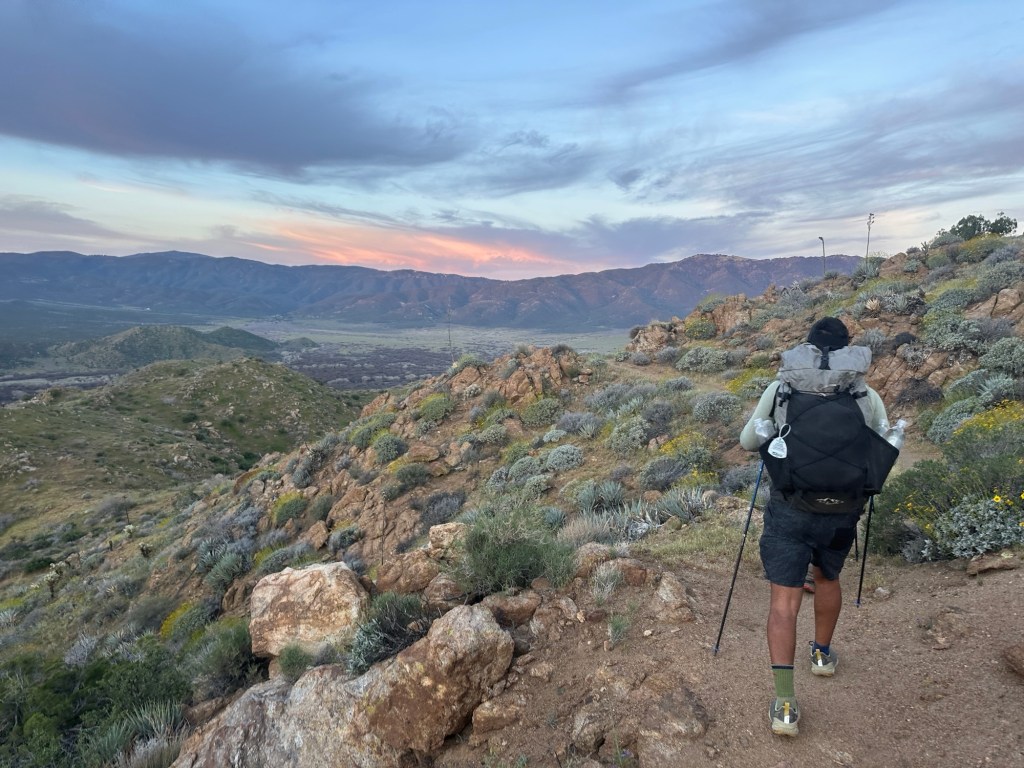
Thursday, March 5, 2026 — Mile 0.0 to 8.8
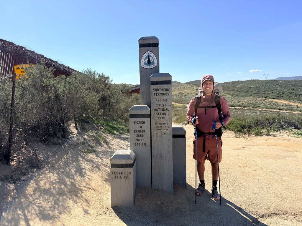
I started the day like many of my weekdays lately: working. But this time, it was different. It was hard to focus on meetings or tasks knowing that by the end of the day I would be standing at the southern terminus of the Pacific Crest Trail. Months of planning had led to this exact moment, and it finally felt real.
Later that afternoon, I drove down to Campo, where the trail begins right along the U.S.–Mexico border wall. Seeing the fence stretch across the dry, open landscape gave the moment a kind of weight that’s hard to describe. This wasn’t just the start of a hike, it was mile zero of something much bigger.
There were a couple of people at the terminus when I arrived. One was volunteering with the Pacific Crest Trail Association and checked my permit. Another introduced himself as a trail angel and gave me his phone number in case I needed anything down the line. That brief interaction set the tone early, the PCT community is real, and people genuinely look out for each other.
With that, I started walking north.
The first stretch of trail eases you in visually, but not physically. The terrain is classic Southern California high desert: dry grasses, scattered shrubs, and rolling hills with wide-open exposure. There’s very little shade, and even in early March, the sun still has some bite during the afternoon. The trail undulates gently at first, but the constant small climbs and descents make the miles feel more substantial than they look on paper.
Within the first ten minutes, I felt the full weight of my backpack in a way I hadn’t before. My back started to ache almost immediately, which made me question whether something was wrong with my setup. I tightened the straps across the front, and the pain eased. About an hour later, it came back. I tightened again. Then again.
Eventually, I stopped completely and adjusted the back straps more carefully.
That seemed to work, at least for now.
It became clear pretty quickly that dialing in pack fit isn’t something you figure out ahead of time. It’s something you earn through miles, discomfort, and constant adjustment. That process would continue all weekend.
Around 4:30 PM, I passed a campground just before descending into Hauser Canyon. A few people called out to me, asking if I was lost. I told them I had just started the PCT and was heading north. They warned me about the canyon ahead, specifically how quickly it gets dark once the sun drops. Sunset was around 5:45 PM, and down in the canyon, light disappears even faster due to the surrounding terrain.
They were probably right.
But I had a campsite in mind and didn’t want to stop short.
The descent into Hauser Canyon marked the first real shift in terrain. The trail drops more steeply, the footing gets rockier, and the landscape starts to feel more enclosed compared to the open ridgelines near the start. As the sun got lower, the temperature began to drop, and the shadows stretched quickly across the canyon.
When I reached the spot I had planned for, it was already full.
At that point, I didn’t have much of a choice. I had to keep moving.
I pushed another two miles, chasing the last bit of daylight. The light was fading quickly, and every minute started to matter more.
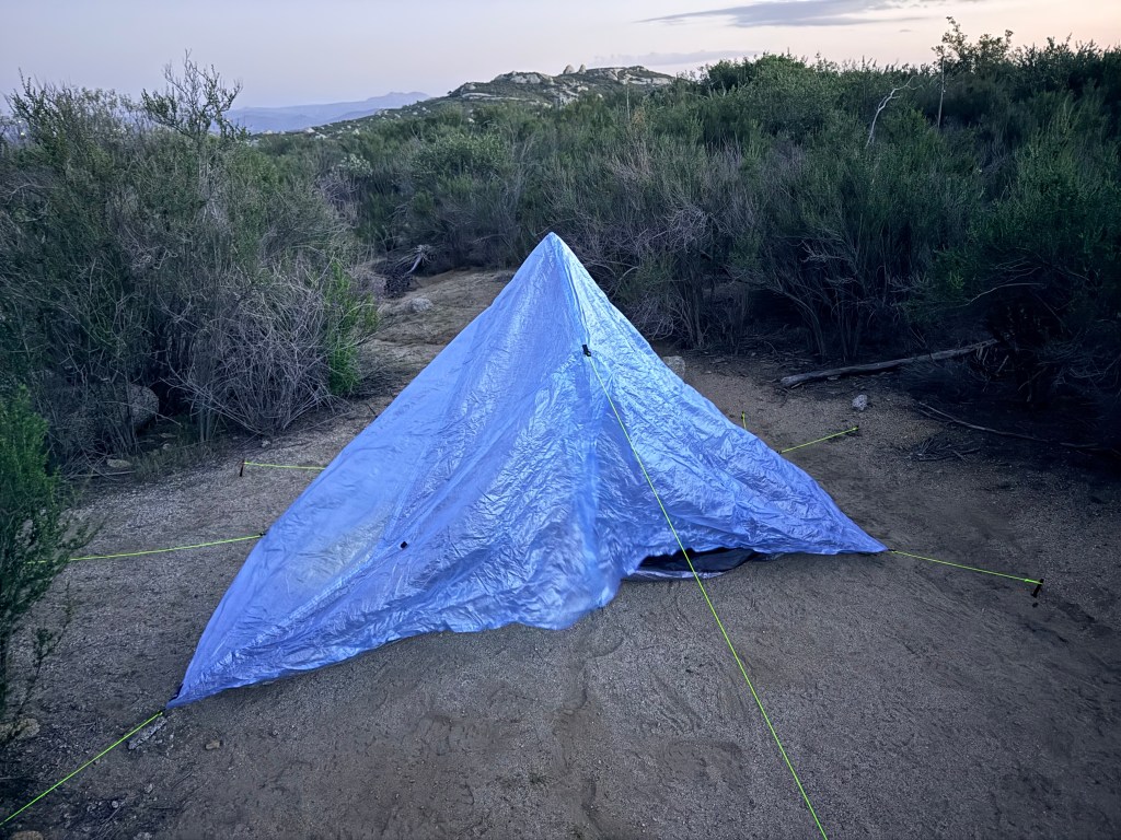
I arrived at the next possible camping area just as the sun was disappearing behind the hills. That gave me about 15 minutes of usable light to get everything set up. It was a scramble, but I managed to get my tent up just before it went fully dark.
This was the first time in my life I had ever slept in a tent.
As soon as the sun went down, the temperature dropped fast. That’s one of the defining characteristics of this section of the PCT, warm during the day, but cold at night due to the dry air and elevation.
I quickly realized I had a learning curve ahead of me with my sleep system.
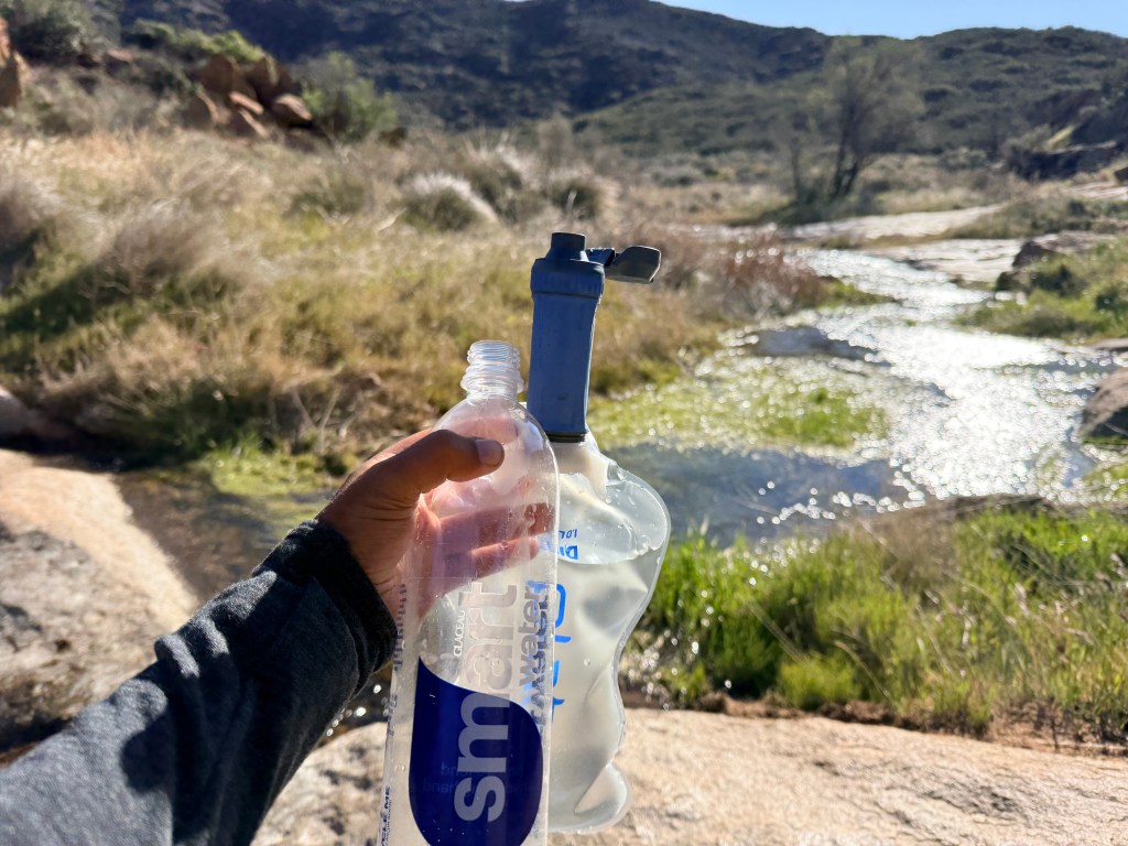
I use an Enlightened Equipment Revelation quilt, which is different from a traditional sleeping bag. It’s open on the bottom and designed to strap to a sleeping pad.
The problem was, I didn’t really know how to use it yet.
I tried putting my sleeping pad inside the quilt, but it felt too tight and restrictive. I could barely move. Eventually, I gave up on that and used the quilt more like a blanket, leaving it open at the top.
That didn’t work particularly well either.
Between the cold air, the unfamiliar setup, and the general awkwardness of sleeping in a tent for the first time, I spent a lot of the night tossing and turning, trying to stay warm, even while wearing my down jacket.
Darkness lasted from about 6 PM to 6 AM, which meant I was in my tent for roughly twelve hours. It felt long, especially being awake for large portions of it.
But even though it seemed like I wasn’t sleeping much, I must have been. I estimate I got around six hours of sleep.
Considering the circumstances, first night ever in a tent, cold conditions, unfamiliar gear, and the start of a thru-hike, it was better than expected.
Not comfortable, but successful.
Day one was officially complete.
Friday, March 6, 2026 — Mile 8.8 to 26.0
The morning started rough.
When I woke up, the inside of my tent was covered in moisture, and my sleeping quilt was damp. Overnight temperatures in this section tend to drop quickly, often into the 30s or low 40s in early March, and with still air in the canyon, condensation builds fast inside a tent. Between my breath, body heat, and the cool outside air, everything had turned clammy.
I used a small microfiber cloth to wipe down the inside of the tent as best as I could. It helped a little, but the bigger problem appeared when I started packing up.
The bottom of the tent was soaked, and because it was wet, dirt and sand had stuck all over it. The ground in this section is a mix of fine dust and gritty sand, which clings to anything damp. It looked like a complete mess. Since it was wet, I couldn’t really clean it properly or fold it the way it was supposed to be packed. Instead, I stuffed it into a trash bag I had brought along and shoved the whole thing into my backpack with the plan of dealing with it later.
Not exactly the smoothest start to the morning.
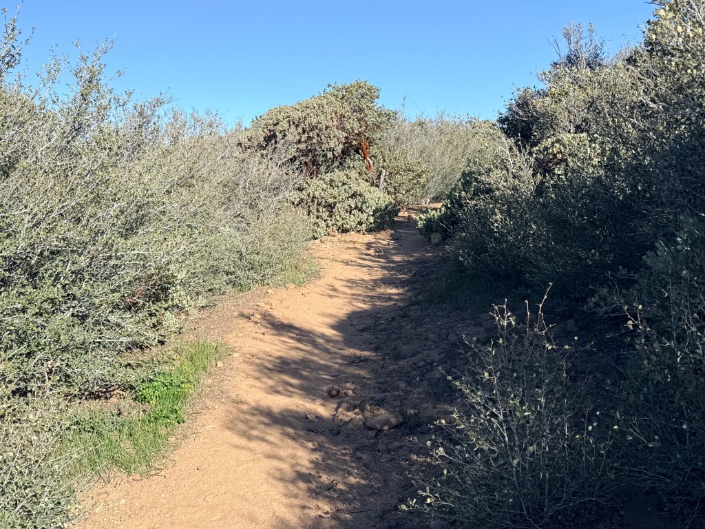
Once I got moving, the trail climbed gradually out of the canyon and back into exposed rolling terrain. This stretch between Hauser Canyon and Lake Morena is classic early PCT: open hills, scattered chaparral, and long sightlines with very little shade. The elevation gain is steady but not extreme, just enough to keep your legs working early in the day.
A little while in, I met a hiker who had camped near a water cache. He told me he planned to hike slowly and spend time exploring side trails and nearby peaks along the way. He also mentioned that he was planning to walk about a mile down the road later that day to help carry additional gallons of water back to refill the cache.
That kind of effort really stood out to me. Water in this section can be unreliable, especially early in the season, and caches like that are often the difference between a comfortable stretch and a stressful one. Seeing hikers contribute to something so essential is a good reminder of how much the trail depends on people looking out for each other.
About ten miles into the day, my shoulders started hurting again from the backpack. I tightened the waist belt a bit more to shift some of the weight onto my hips, which helped somewhat. I was still clearly in the phase of figuring out the right adjustments for my pack, and every few miles felt like another experiment.
Eventually I reached Lake Morena County Park. By that point, I was pretty tired and starting to feel slightly nauseous, likely a combination of exertion, sun exposure, and still dialing in food and hydration.
The stop ended up being exactly what I needed.
For the first time since starting the trail, I had access to a real restroom. Even better, I had the chance to lay out my tent and let it dry in the sun. The midday conditions helped a lot, clear skies and dry desert air make this one of the best places early on to reset gear. Once the tent fully dried, the dirt and sand that had been stuck to the bottom simply fell off. After that, I could finally fold it up properly and pack it the way it was intended.
There were also a few wild turkeys wandering around the campground, which felt oddly out of place in the otherwise dry landscape.
After resting for a bit, I continued hiking toward Boulder Oaks Campground. The trail out of Lake Morena gradually climbs again, moving through more oak-dotted terrain with slightly more vegetation than earlier in the day. By the afternoon, winds had started to pick up, and this area is known for exposure. Ridgelines here don’t offer much protection, and gusts can build quickly.
Originally, I hadn’t planned to stop at Boulder Oaks. My goal was to push mileage and get closer to 25 miles for the weekend stretch.
But things changed when I spoke with a Forest Service staff member at the campground.
She mentioned that winds were expected to reach around 45 mph that night. Given how exposed parts of the trail are beyond this point, that wasn’t something to take lightly.
At the same time, I started doing some quick math.
From here, I have roughly 680 miles to Kennedy Meadows. Even averaging around 60 miles per week would still get me there before June 1st. Since most hikers don’t enter the High Sierra until mid-June or later due to snow conditions, arriving too early would actually create a different problem.
That realization changed my mindset.
Up until then, I had been treating every mile like it needed to be maximized. But the numbers suggested I didn’t need to push nearly as hard as I thought. Sixty to seventy-five miles per week would be enough to stay on track.
With that pressure gone, the decision became easy. I stayed at Boulder Oaks Campground.
The campground staff handed out fresh oranges, which tasted better than expected after a full day of hiking. At that point, simple food felt like exactly what my body needed.
That evening, I met a few other hikers. One guy from Salt Lake City had already completed the Continental Divide Trail, so he brought a different level of experience to the conversation. I also met a couple from Switzerland who were traveling together. We ended up eating dinner and talking for a while about politics, culture, and life in different countries.
It was one of those moments that you don’t necessarily expect going into something like this, but quickly becomes one of the highlights. People from completely different backgrounds, all sharing the same temporary routine on the same trail.
I took advantage of the campground to charge my devices, then set up my tent again for the night.
With some advice from the hiker from Salt Lake City, I finally figured out how to use my quilt more effectively. Instead of leaving it open like a blanket, I wrapped it around myself like a cocoon, with the open side underneath me.
That small adjustment made a noticeable difference.
I slept better that night, at least from about 8 PM until midnight, which already felt like meaningful progress compared to the night before.
Saturday, March 7, 2026 — Mile 26.0 to 41.5
I was glad I decided to stay at Boulder Oaks Campground, because the wind that night was no joke.
Even with shrubs and trees around my tent providing some protection, the gusts were still strong enough to rip out one of my tent stakes around 2 AM. The wind had been building for hours, and in this stretch of the PCT, that’s not unusual. The trail climbs into more exposed ridgelines, and weather funnels through these areas with very little resistance. Fixing the stake was quick, and I had to get up anyway, so it wasn’t a major disruption, but it was a reminder that conditions out here can shift quickly.
I got up around 6 AM and started packing around 6:45. To my surprise, I was the first one awake. I had assumed everyone on the PCT would be up at sunrise, but that clearly isn’t always the case. I tried to be quiet, though stuffing gear into a backpack is never as silent as you think it is.
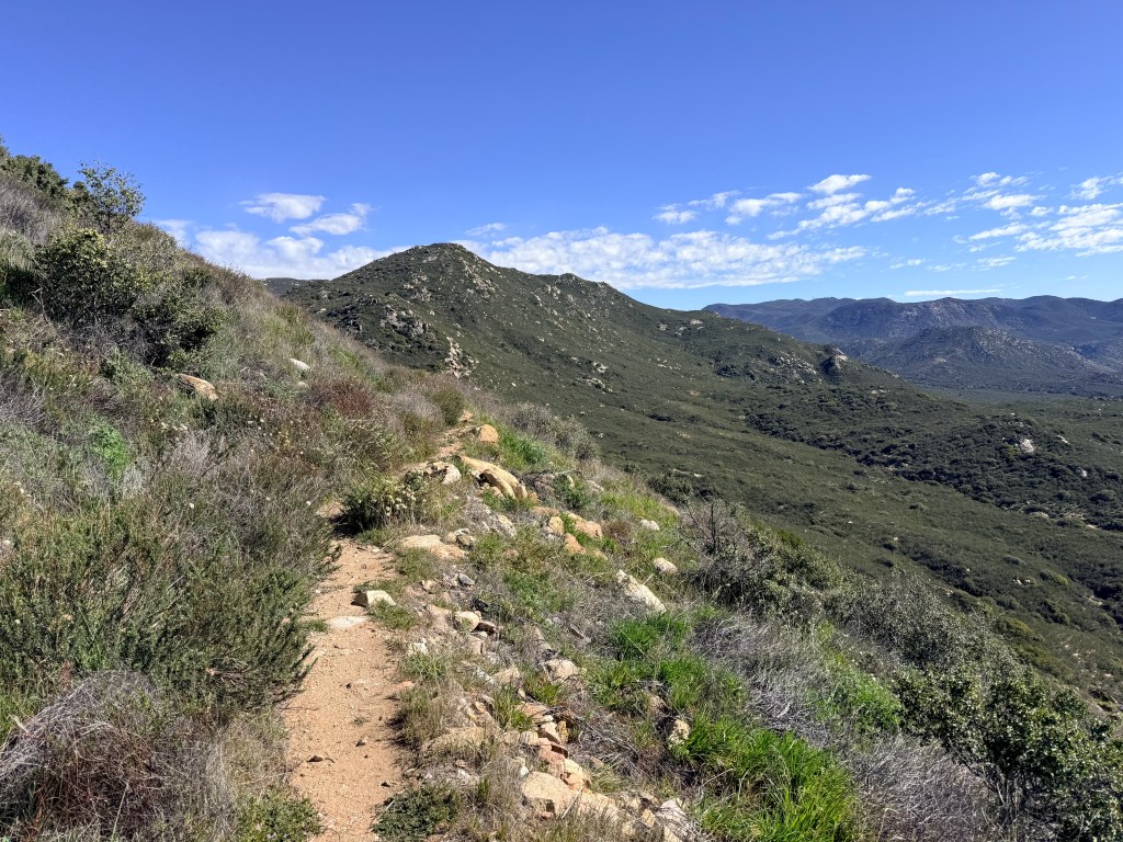
I wanted an early start because the day ahead was a big one. The trail climbs roughly 3,000 feet over about 15 miles as it works its way up toward Mount Laguna. It’s one of the first sustained climbs on the PCT, and it marks a noticeable transition in both terrain and environment.
The climb humbled me quickly.
For the first five miles, I actually felt great. The trail gradually gains elevation through rolling hills and chaparral, with long, exposed stretches and views back toward the desert. But as the elevation increases, the environment begins to shift. Vegetation thickens slightly, the air cools, and you start moving toward more pine-dotted terrain.
At the same time, the wind never let up.
With gusts pushing into the 40 to 45 mph range, every uphill section felt harder than it should have. It wasn’t just the grade, it was the constant resistance. Every few steps felt like walking into a wall of air.
Eventually, the familiar shoulder pain returned as the weight of the backpack settled back in. Between the climb, the wind, and the pack, the effort started to stack.
At one point, I passed a few hikers who were section hiking the trail every Saturday. When they found out I was attempting the full PCT, they asked if they could take a photo with me. They treated me like I was doing something far more impressive than it felt in the moment. It was unexpected, but it gave me a real boost at the right time.
Around 13 miles into the day, things started to shift.
The nausea crept in slowly at first, then picked up quickly. As I got closer to the higher elevations near Mount Laguna, the climb felt steeper, and my energy dropped off hard. The final miles became a grind.
When I finally reached the summit area and continued about another mile, I hit a wall completely.
The nausea took over.
I walked over to a fallen tree, checked the area for snakes out of habit, and sat down. My stomach felt twisted, and the dried fruit I had eaten earlier left a sour, lingering taste. Within minutes, I vomited three times.
That moment triggered a wave of panic.
The last time I had thrown up during a hike was on the Bright Angel Trail in the Grand Canyon, and that experience had escalated into something much worse, hyponatremia, dehydration, and early heat-related illness. A ranger had to step in, and getting out of the canyon afterward had been one of the hardest physical efforts I’ve ever gone through.
So when it happened again here, all of that came rushing back.
For a few minutes, I thought I might be heading down the same path.
But this time was different.
After sitting for a bit and letting my body settle, the nausea started to fade. My stomach calmed down, and I was able to stand up and keep moving. The cooler temperatures at elevation, likely in the 50s compared to the warmer lower sections earlier, probably helped stabilize things.
I continued on toward Burnt Rancheria Campground.
Near the campground is Pine House Cafe and Tavern, and I decided to stop. I ordered a vegan burger and fries and sat inside while waiting.
That’s when everything caught up with me.
Sitting still, in a warm and comfortable space after a physically and mentally draining climb, the emotions hit all at once. I started tearing up. Part of it was the memory of the Grand Canyon experience resurfacing. But part of it was doubt. For a few minutes, I genuinely questioned whether I was cut out for something as demanding as the PCT.
I stepped outside so no one would notice and gave myself a few minutes to reset.
Then I went back in and ate.
The burger and fries were exactly what I needed. After a day like that, it felt like my body immediately recognized it.
After eating, I looked into camping options nearby, but most places were still closed for the season, including the campground itself. At that point, the decision became practical.
I decided to head back to my RV at Oakzanita Springs and recover.
One of the other hikers ended up paying $130 for a nearby cabin. When I compared that to the cost of gas, even at $6.20 per gallon, driving back still made more sense.
Back at the RV, I focused on recovery. I drained my blisters, took a long shower, and spent the evening watching episodes of Vikings.
It wasn’t how I had pictured the night ending, but it was the right call.
On a trail this long, pushing through everything isn’t always the goal. Sometimes the smarter move is to stop, recover, and give yourself a better chance for the miles ahead.
Sunday, March 8, 2026 — Mile 41.5 to 59.5
I woke up around 7:00 AM back at my RV feeling more rested after the previous day’s struggles. I made a big bowl of Special K with Protein cereal, which felt like a luxury compared to typical trail food.
After breakfast, I drove back to Burnt Rancheria Campground, where I had left the trail the day before.
Because I was only planning to be out for the day and would return to the RV that night, I switched from my full backpacking setup to my trail running pack. With water and essentials, the whole setup weighed about 10 pounds, compared to the 30 to 35 pounds I had been carrying.
The difference was immediate.
Looking at the map, I really only had two realistic options for the day. The next road access points were about 18 miles away or 35 miles away, so those became the targets.
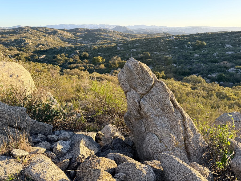
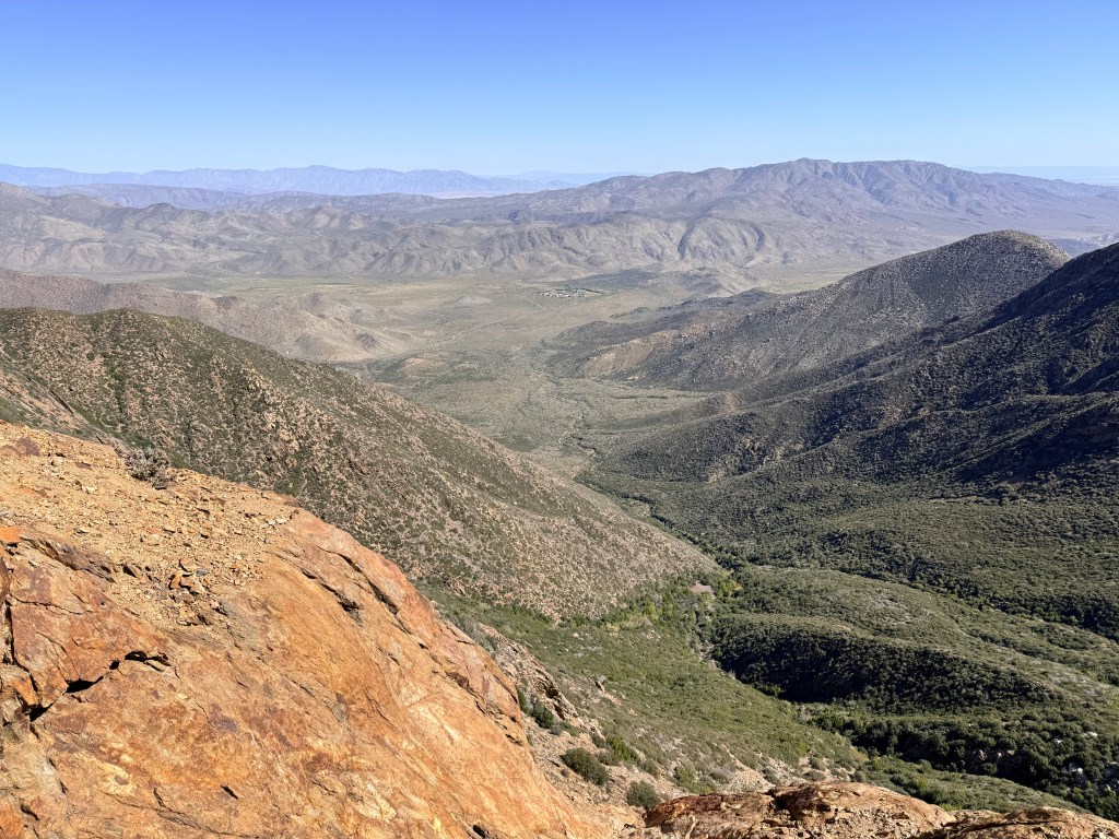
The terrain out of Mount Laguna shifts quickly. Within a few miles, the forested feel gives way to more exposed, desert-facing slopes as the trail descends toward the San Felipe Hills and eventually Scissors Crossing. The trail contours along canyon walls for long stretches, with steep drop-offs and wide, open views into Anza-Borrego Desert below.
For the first 10 miles, I felt strong.
My strategy was simple: run the flats and downhills, hike the climbs. I settled into an average pace of around 13-minute miles, and for a while, the 35-mile option actually felt within reach.
The weather was clear and sunny, but the wind was still relentless. Gusts pushed across the ridgelines and funneled through the canyons, sometimes hitting from the side, sometimes straight on. Even without the pack weight, it added a constant layer of resistance.
Despite that, this was one of the most visually impressive sections so far. The trail carved across the side of a massive canyon, with long, gradual descents and sweeping views that stretched for miles. The landscape felt bigger and more dramatic than the earlier miles near Campo.
Trail running changed the experience completely.
On a rocky trail like this, you don’t get to zone out. Every step requires attention. The ground was uneven and covered in loose rock in many places, and between the wind and the speed, there was no room for distraction. It forced me into a kind of constant focus that felt very different from hiking.
After about 10 miles, things started to shift.
I began feeling pain in my big toes. Every so often, I would clip a rock, and each time it sent a sharp jolt through my foot. At the same time, my ankle was rubbing against the back of my shoe, creating another point of irritation.
By mile 15, the pain was getting worse, and the idea of pushing all the way to Scissors Crossing started to feel less realistic.
Around 12:30 PM, I stopped to eat a snack and take a short break. But when I stood back up, everything felt worse. My feet hurt more, and my legs and back had stiffened up during the stop.
That was the turning point.
Instead of pushing for 35 miles, I decided I would go three more miles to the next road crossing and call it there.
It was frustrating to make that decision. I had started the day feeling strong, and mentally I wanted to see how far I could go. But physically, it was clear that continuing would come with consequences.
Later that evening, that became obvious.
When I took off my shoes, I saw that both of my big toenails were bruised, red underneath, and getting more painful by the hour. If I had pushed another 17 miles, I could have easily made it much worse and potentially sidelined myself for longer.
The frustrating part was how preventable it probably was.
My toenails were too long.
That night, I clipped them, something I should have done before starting the hike. It was a simple mistake, but one that made a noticeable difference.
After that, I spent the rest of the evening at the RV recovering and letting my feet calm down.
The weekend on the trail was over.
The next day was Monday, which meant switching back into work mode before heading out again for the next stretch. It wasn’t the clean, high-mileage weekend I had originally imagined, but it was productive in a different way.
I was starting to understand how to manage the trail, my gear, and my body, and just as importantly, when to push and when to stop.
Monday–Wednesday, March 9–11, 2026 — 0 Miles
Monday through Wednesday were zero-mile days, which meant stepping away from the trail and shifting back into my normal weekday routine of working.
In hindsight, the timing worked out well.
My big toes were in rough shape after the trail running attempt. Every step carried a dull, lingering pain, and at night they would throb constantly. The toenails were visibly bruised, with blood pooled underneath, and the surrounding areas were tender. Walking was still manageable, but it was clear that pushing more miles too soon would have made things worse.
These days became less about hiking and more about recovery and logistics.
I stayed mostly around my RV setup and focused on work. Compared to the constant movement and exposure of the trail, the stillness felt strange. Just a day earlier, I had been navigating rocky descents and fighting wind on exposed ridgelines. Now I was sitting in one place, dealing with emails and meetings.
On Wednesday, I relocated my RV from Oakzanita Springs Campground to Culp Valley Primitive Campground. The move set me up better for the next section of trail, placing me closer to the desert stretch ahead near Scissors Crossing. The environment also shifted noticeably. Oakzanita sits higher with more trees and cover, while Culp Valley is more exposed, with wide-open desert views, stronger winds, and a more remote feel.
Living and working out of the RV introduced a different kind of challenge: power management.
I rely on a Jackery battery system paired with two solar panels to run everything, including my laptop and Starlink internet. But one of the panels had broken, and the other was only generating about 38 watts at peak sunlight. Out in this terrain, with clear skies, that should have been much higher.
That output was barely enough to keep up with work demands.
As a result, I had to start rationing power carefully. Work took priority, which meant everything else became secondary. Device charging had to be timed, and anything non-essential, especially entertainment, was cut back.
At one point, I went into town and spent time at Pablito’s Mexican Bar and Grill. It was partly for food, but also just to sit somewhere with reliable power and not worry about draining my own system.
Even with the downtime, my toes were still hurting by Wednesday night. The bruising hadn’t gone away, and each step was a reminder of how much damage had been done in a single day of pushing too hard.
That made me slightly uneasy.
The plan was to get back on the trail the next day. I was hoping the rest had been enough, but it wasn’t entirely clear yet whether my feet were ready for it.
Thursday, March 12, 2026 — Mile 59.5 to 61.5
Thursday followed the same pattern as the rest of the week, a full day of work before even thinking about the trail.
By the time I finished, I debated whether it made more sense to wait until Friday morning. My toes were still hurting, and another day of rest might have helped slightly. But realistically, they weren’t going to improve much overnight. I decided to go.
On the way to the trailhead, I stopped in Julian at Mom’s Pies and ordered a slice of apple pie with cheddar cheese melted on top along with a coffee. It sounds like a strange combination, but it worked. After a few days of rationing power, managing logistics, and dealing with lingering pain, it felt like a reset.
Driving out of Julian toward the trail, I had a thought to check if there were any outdoor stores nearby. I opened Google Maps and searched for shoes.
That’s when Two Foot Adventures showed up.
I called and asked if they had size 8.5 hiking shoes. They said yes. I pulled over immediately and went in.
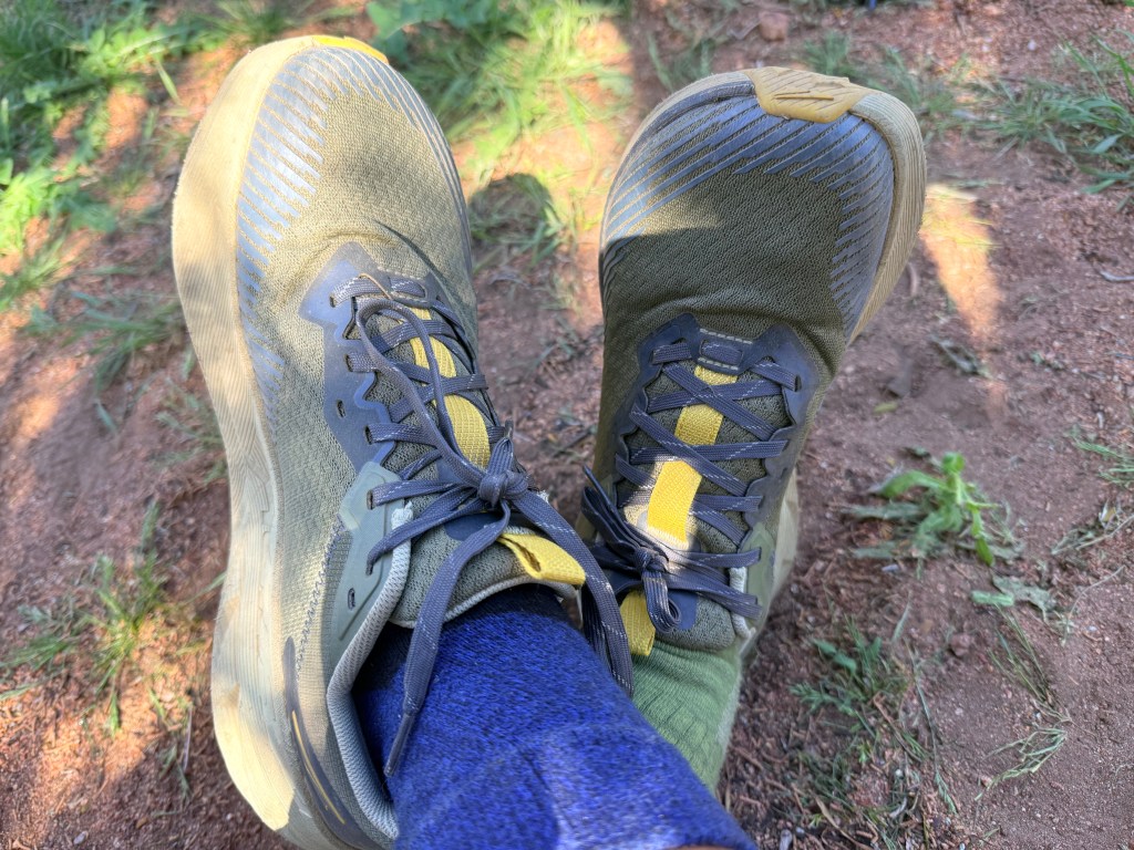
The woman working there, who I’ll call Sarah, listened to what I had been dealing with and brought out a pair of Altra Experience Wild 2s. They were on sale for under $100. As soon as I tried them on, the difference was obvious. They fit correctly, which was something my previous shoes hadn’t. I had been hiking in size 8s, and that mismatch had likely been the cause of the bruised toenails.
It felt like a small but critical correction.
From this point forward, I’ll be using fake names for people I meet on the trail. It keeps things simple and avoids sharing anyone’s real identity while still making the experience easier to follow.
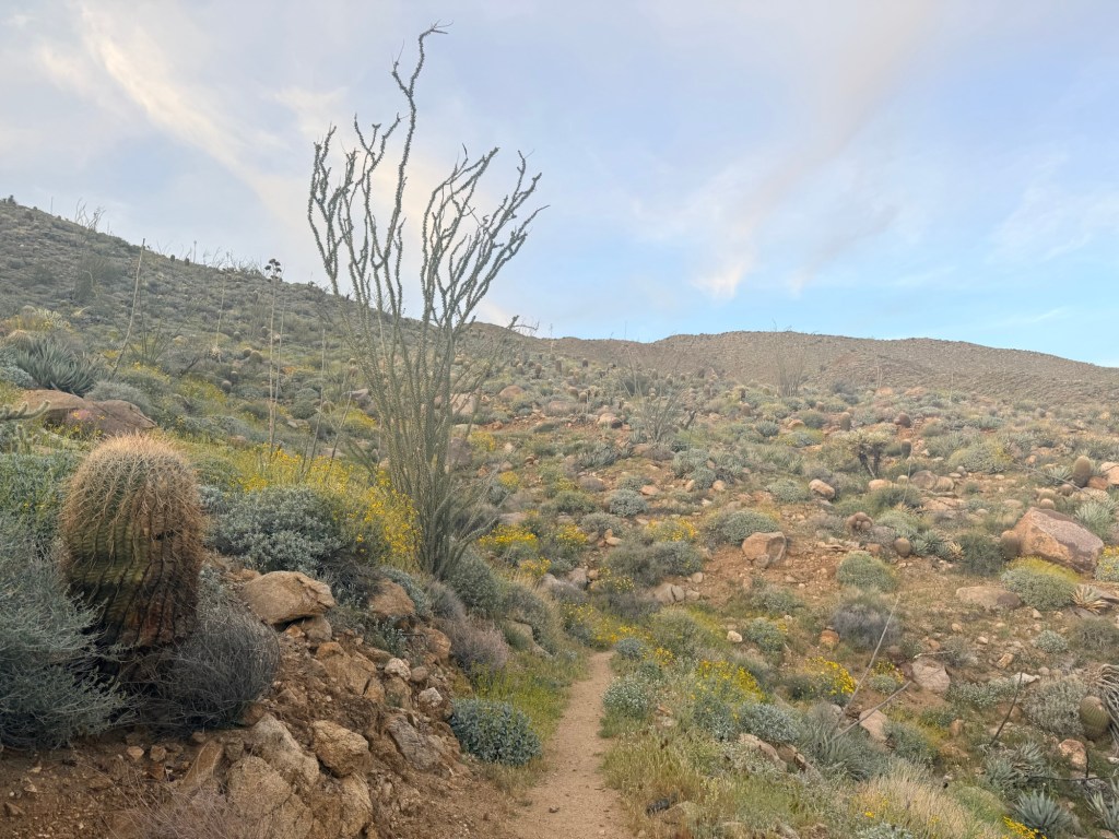
When I arrived near the trailhead around Scissors Crossing, the environment was noticeably different from earlier sections. This area sits lower in elevation and is fully exposed desert, with dry air, loose rock, and very little vegetation. The sun hits hard during the day, and temperatures drop quickly once it sets.
At the parking area, I saw two hikers searching around for water. They told me they had completely run out and that the source they had planned to use was dry.
I had extra water stored in my Jeep, so I gave them two liters each. They were extremely grateful.
After talking for a bit, they invited me to hike with them. I’ll call them Omar and Leora.
Omar had been born in Iraq and now lives in New Jersey, while Leora was a recent college graduate from Israel. It was another example of how quickly connections form on the trail, even between people who had never met before.
Since it was already late in the afternoon, we only managed about two miles before sunset. The terrain here is rocky and uneven, with sections of loose footing that require attention even at slower speeds. The trail moves through open desert slopes and shallow canyon terrain, with wide views but very little protection from the elements.
But those two miles told me everything I needed to know.
My toes didn’t hurt.
After days of pain and uncertainty, the relief was immediate. The new shoes made a noticeable difference right away. It confirmed that the issue hadn’t just been mileage or terrain, it had been fit.
We found a spot to camp and talked for a while before settling in for the night.
Even though the day had been warm, the temperature dropped quickly after sunset, which is typical in this desert section. The thermometer read around 57°F, but it felt significantly colder, likely due to wind exposure and the dry air.
I lay in my tent for nearly two hours before finally falling asleep.
When I woke up, I reached for my phone, expecting it to be around 4 AM.
It was 11:45 PM.
I was completely awake.
At that point, it felt like the night was just getting started.
Friday, March 13, 2026 — Mile 61.5 to 79.4
The night did not go particularly well.
Between midnight and 6:00 AM, I probably slept only about two hours total. I felt cold throughout the night, and once again my sleeping quilt collected moisture. That combination, cold air and condensation buildup, has been a recurring theme in these early miles. Even with poor sleep, I was surprised that I didn’t feel completely drained when it was time to pack up and start hiking.
That morning I continued hiking with Leora and Mawan, which was a welcome change from being alone. Having people to talk to breaks up the monotony of long miles. Conversation makes time pass faster and gives your mind something else to focus on besides the constant rhythm of walking.
The tradeoff was pace.
We moved slower than I normally would and stopped more often so everyone could stay comfortable. Mawan was carrying a 50-pound pack, which is extremely heavy for the PCT and clearly taking a toll on him. He mentioned he was looking forward to reaching Julian so he could take a zero day and swap out some of his heavier gear.
The terrain in this stretch continues through exposed desert hills, with rolling climbs and descents across open ridgelines. The trail surface is a mix of packed dirt and loose rock, and there’s very little shade. By late morning, the sun starts to feel strong again, especially at the lower elevations near Scissors Crossing.
About six miles in, my shoulders started hurting again from the backpack.
At that point, it had become a recurring issue, and I was getting frustrated. I jokingly asked out loud if anyone nearby happened to be a backpack expert.
As luck would have it, a hiker who was about to pass me overheard and stopped.
He walked me through a much better way to adjust my pack. First, he had me tighten the shoulder straps and waist belt firmly so the weight sat properly on my hips. Then he explained that the chest straps should actually be looser than I had been using them, adjusted only slightly for stability rather than tension.
The result was immediate.
Once everything was dialed in correctly, the shoulder pain disappeared. It was a simple adjustment, but it felt like a major breakthrough.
About three miles before reaching the road crossing, I met another hiker named Michael, a recent high school graduate from Las Vegas. He was moving at a faster pace, and since I was ready to pick things up again, I asked if I could join him.
We continued together toward Scissors Crossing.
This section descends more noticeably into the desert, with wide-open canyon views and long, exposed switchbacks. The terrain feels harsher here, drier, rockier, and more unforgiving, especially as you drop in elevation.
When we reached the road, we planned to hitch into Julian for food.
Hitchhiking took longer than expected. We stood there for about an hour before someone finally stopped. By then, Leora and Omar had caught up and joined us.
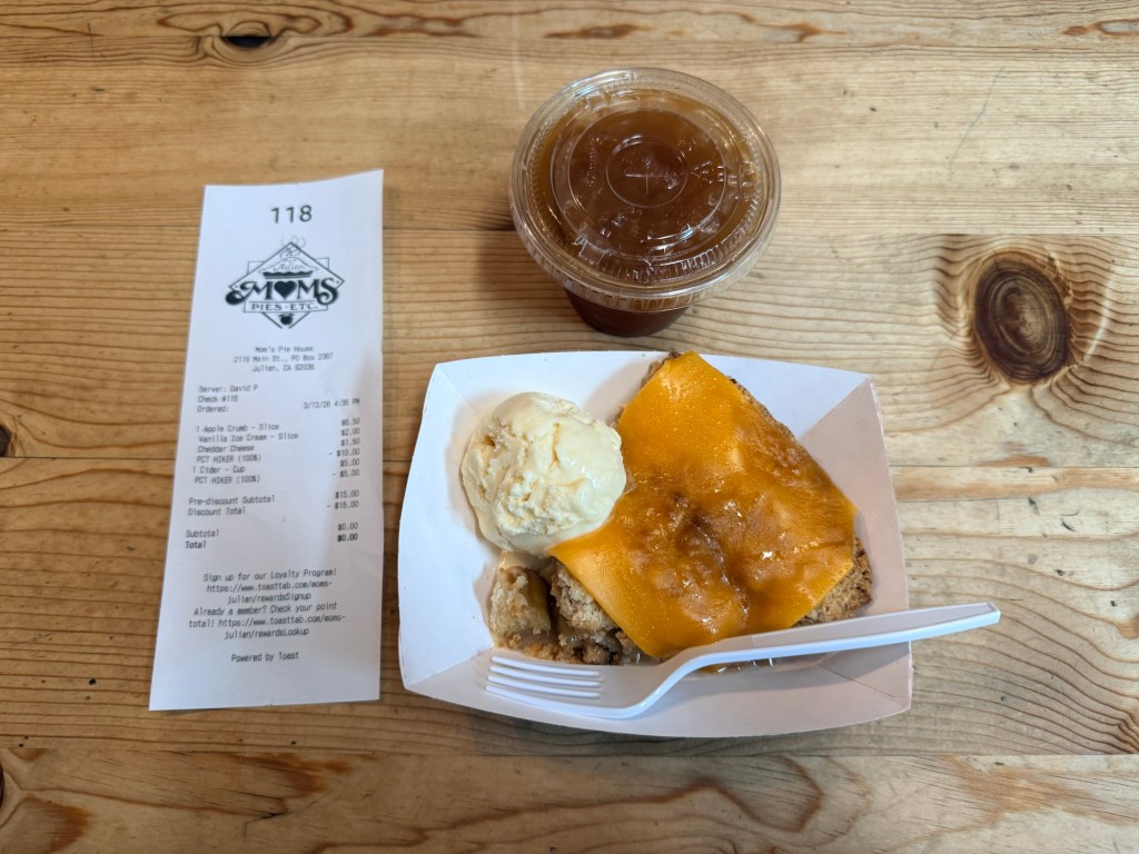
Once in Julian, we went straight to Mom’s Pies after hearing they were offering free slices to PCT hikers.
The rumor turned out to be true, and then some. They were also handing out ice cream, cheddar cheese, and cider, all free.
I ordered apple pie again, along with a spinach empanada and a Coca-Cola.
After days of trail food, sitting down to real food felt like a complete reset. It’s one of those moments on the trail where everything feels easier for a little while.
After eating, the group split.
Leora and Oman decided to stay in Julian and take a zero day. Meanwhile, Roman and I teamed up with two other hikers I’ll call Lacy and Kelsey.
The four of us caught a ride back to the trail with a trail angel named Sprinter, then continued hiking.
We covered about two more miles before stopping at a small campground tucked into a narrow ravine. The terrain here shifts again, more enclosed, with steeper walls and scattered rock formations surrounding the site.
Along the way, we noticed some strange-looking spiders that resembled small beans with legs, an odd and slightly unsettling sight.
This was also my first time setting up camp in the dark.
Using a headlamp made it manageable, but it came with a new challenge. The light attracted insects, and I had to be careful to keep them from getting inside the tent while setting everything up.
Unlike the previous night, the temperature felt noticeably warmer. Instead of layering up, I ended up taking off my shirt and using my quilt loosely like a blanket.
I woke up a few times during the night, but overall I probably got around six hours of sleep, which felt like a big improvement.
The only thing that stayed in the back of my mind was the terrain around our campsite. The cliffs above us were covered in loose-looking rocks and boulders, and it was hard not to imagine one of them breaking free and sliding down toward the tents.
The others reassured me that it was extremely unlikely. Without rain or strong wind, rockfall in that area wasn’t something to worry about.
Still, it crossed my mind more than once before I finally fell asleep.
Saturday, March 14, 2026 — Mile 79.4 to 94.4
I woke up around 5:30 AM along with the rest of the group. We decided to start hiking before sunrise so we could cover miles while the air was still cool.
Two of the biggest issues I had been dealing with earlier in the week were finally resolved. My back and neck pain were gone after learning how to properly adjust my backpack, and my toe pain had disappeared thanks to the new shoes I bought in Julian.
But solving those problems revealed new ones.
A sharp pain started developing in my right ankle, right where the side of my shoe pressed against it. The trail in this section often follows sloped ridgelines that tilt slightly, and over time that subtle angle adds up. My right foot was landing unevenly with each step, and the repeated pressure created a consistent point of irritation.
At the same time, the area where my toes meet the rest of my foot started becoming sore. I wasn’t completely sure what was causing it, but the others suggested it might be related to the plantar fascia. Whenever I stopped and massaged the area for a few minutes, it seemed to help, at least temporarily.
The terrain throughout the day made these issues more noticeable.
This stretch north of Scissors Crossing moves through exposed ridgelines and rolling hills near the Ranchita area. The trail alternates between compact dirt and loose rock, with long traverses across slopes that rarely feel level. There’s almost no shade, and even early in the day the sun starts to build quickly. By midday, the heat becomes a constant factor again.
We rotated positions throughout the hike.
I tried not to take the lead too often. Part of that was practical, I didn’t want to be the first to encounter a snake, and part of it was pacing. The group was moving at around 21-minute miles, and I didn’t want to slow things down.
My preferred position was second.
Rotating positions ended up being one of the best parts of hiking in a group. Every shift naturally paired you with someone new, which led to one-on-one conversations throughout the day. By the end of the hike, I had spent time talking individually with Michael, Lacy, and Kelsey.
One thing that has stood out so far is how open and interesting people are out here. Almost everyone has a different background and a different reason for being on the trail, which makes even simple conversations feel meaningful.
The landscape continued to evolve as we moved north.
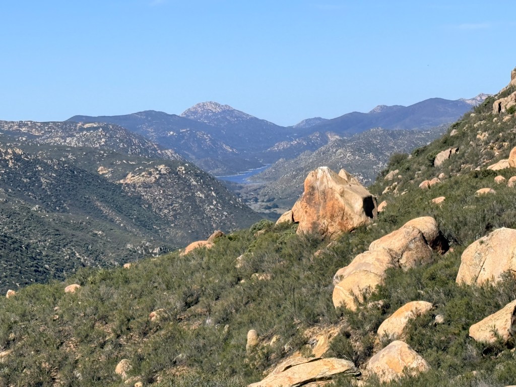
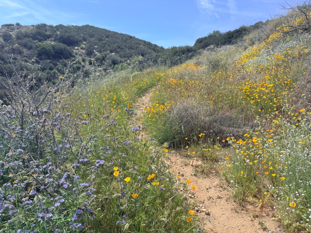
Over the past 70 miles, the transition has been gradual but noticeable. Near Campo, everything felt dry and sparse, dominated by desert scrub and sand. Climbing toward Mount Laguna introduced pine trees, cooler air, and more rugged terrain. Now, in this section, the environment blends the two. Rolling grassy hills mix with chaparral and low shrubs, and the views open up across wide valleys and distant ridgelines.
It feels less like a harsh desert and more like a rugged highland.
I wasn’t just learning from my own experience, I was also learning from the people around me.
Near one of the water caches, Michael accidentally stepped on a cholla cactus. The spines latched onto his shoe instantly. They’re called jumping cactus for a reason, they attach easily and are difficult to remove. We used pliers and duct tape to pull them out.
That was enough to reinforce a simple rule: don’t walk around barefoot out here, even for a moment.
Michael also shared a cooking trick. He keeps his ramen in a ziplock bag, pours boiling water directly into it, and then places the bag inside his pot to act as a bowl. It keeps the pot clean and eliminates the need to wash anything afterward.
It’s the kind of small efficiency that makes a lot of sense on a long trail.
We reached our planned campsite before sunset, which felt like a win after a few earlier nights of rushing to set up in the dark.
While getting settled, I ran into another issue. My battery pack was completely dead. I ended up borrowing power from Kelsey so I could charge my phone.
That made it clear that my current 20,000 mAh battery might not be enough for this setup. I’ll likely upgrade to a 40,000 mAh pack going forward.
That night, the wind returned.
Strong gusts pushed against the tent for hours, occasionally pressing the walls inward enough to brush against me. The noise was constant, and it made it difficult to fall into a deep sleep.
In the end, I probably got around four to five hours.
We had gone to sleep around 8:00 PM and planned to wake up at 5:00 AM, so there was enough time in the tent to recover, even if the sleep itself wasn’t ideal.
It was another reminder that out here, even when things go right, something else always adds a new layer to the experience.
Sunday, March 15, 2026 — Mile 94.4 to 109.5
We woke up again before sunrise, packed up camp, and started hiking while the sky was still dim. Early starts had already become part of the routine. The cooler morning air made the first few hours much more comfortable, especially in this exposed section.
For the first time since starting the trail, two of my biggest issues felt fully resolved. My back and neck pain were gone now that I understood how to properly adjust my backpack, and my toes were no longer hurting thanks to the new shoes.
My feet were still a little sore, especially near the ball of my foot, but it was manageable. Whenever we stopped, I would sit down and massage them, which helped enough to keep moving comfortably.
The group was clearly settling into the rhythm of trail life. We were moving efficiently and had already covered a good amount of distance before 10 AM.
About eight miles into the morning, we reached a road crossing near Ranchita. Paula met me there so I could swap my full backpack for my trail running pack again. Since I planned to return to the RV that night, carrying the lighter setup made more sense.
I also grabbed a bag of Cuties oranges from my Jeep and handed one to each of my hiking partners, Michael, Lacy, and Kelsey. Fresh fruit on the trail feels completely different from anything else. After days of dry, packaged food, something cold and juicy stands out immediately.
At the same time, I was aware that I was lightening my load while everyone else continued carrying full packs. It felt slightly unfair, even if it made sense for my setup.
As we continued north, the landscape shifted again in a way that felt almost surprising given the miles behind us.
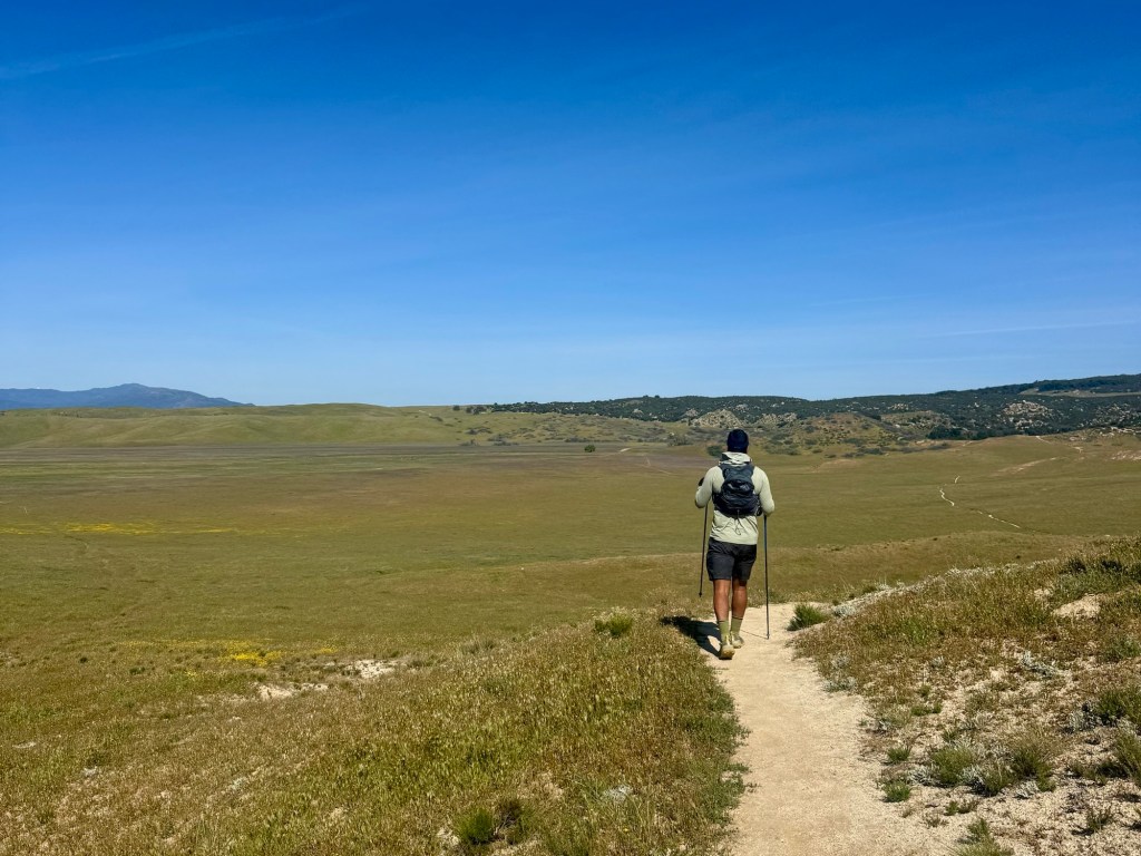
The early sections near Campo were dry and sparse, dominated by desert scrub and sand. The climb toward Mount Laguna introduced pine trees and cooler air. But north of Ranchita, the terrain opens up into wide, rolling meadows.
Tall grasses covered the hills, moving with the wind in slow, wave-like patterns. With clear skies and temperatures around the low 80s during the day, the environment felt much more open and alive than the harsher desert stretches earlier on. A steady breeze moved across the landscape, and at times it looked like the hills themselves were in motion.
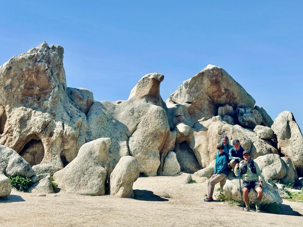
Eventually, we reached one of the most recognizable landmarks on this part of the trail.
Eagle Rock.
From the right angle, the formation looks almost exactly like a giant eagle with its wings spread. It’s one of those places where nearly every hiker stops, and for good reason. The shape is oddly precise, and it stands out against the surrounding terrain in a way that feels intentional.
We took a short break there, along with the usual photos.
Not long after, we came across what looked like a rattlesnake stretched across the trail. Everyone slowed down and gave it space while we tried to figure out what we were looking at. After a closer look, we realized it was a gopher snake. It had a similar pattern and posture, but without the rattle.
Even knowing it was harmless, it was a good reminder to stay alert.
Past Eagle Rock, the trail gradually shifted again. The open meadows gave way to sections of oak trees and chaparral, with more shade than we had seen in previous days. We also passed alongside a small stream, which stood out after so many dry miles earlier in the hike.
As we approached Warner Springs, the trail trended downhill. The descent felt gradual but noticeable, especially after the rolling ridgelines earlier in the day.
Reaching the Warner Springs Community Center marked a clear milestone.
This is generally considered the end of the Campo to Warner Springs stretch of the PCT.
After days of trail food, the first priority was obvious.
I bought a burrito, some cheese, and a Poppi soda, and it felt like exactly what my body needed. Real food after several days of bars and snacks hits differently.
Even better, I was able to take a shower, my first in four days, which made a noticeable difference both physically and mentally.
Eventually, it was time to say goodbye to the group.
One of the realities of long-distance hiking is that people naturally split up. Different schedules, pacing, and plans pull people in different directions. There’s a good chance I may not see them again.
After saying goodbye to Michael, Lacy, and Kelsey, I drove back to my RV at Culp Valley Primitive Campground.
The next few days would be back to work, recovery, and preparation for the next section of the Pacific Crest Trail.

Leave a comment